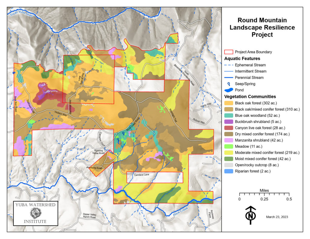
The Round Mountain Landscape Resilience Project seeks to improve forest health and resilience to wildfire, drought, and bark beetles on 1,230 acres of federal and private land in Nevada County.
The project is currently in the planning and environmental compliance phase, with funding from the Sierra Nevada Conservancy’s Prop 68 grant program. The Yuba Watershed Institute (YWI), in partnership with the U.S. Bureau of Land Management, the Bear Yuba Land Trust (BYLT), and local residents, is creating a forest management plan for this area. In addition, the YWI will hire consultants to complete cultural and biological surveys and reports to support required environmental reviews. Most of the project area is part of BLM’s South Yuba Recreation Area. The site is about three miles north of Nevada City on the ridge above the South Yuba River.
Round Mountain is a large area of contiguous protected public and private land between Nevada City and the South Yuba River. The private land included in this project is under conservation easements held by BYLT. The overall landscape consists of mixed conifer, oak woodland, and open meadows. Current forest conditions are heavily overgrown and highly vulnerable to wildfire in an area of high residential population density.
This is an area of high recreational use for hiking and mountain biking. In addition, Rock Creek, a tributary to the South Yuba River, flows through the site. The South Yuba joins the main stem Yuba River a half dozen miles downstream and them immediately fills Englebright Reservoir. This water is managed by the Army Corps of Engineers and Yuba Water Agency to supply 60,000 acres of productive farmland.